

A HISTORIC village route has been officially recognised as a restricted byway.
South Cerney Parish Council’s bid to add a length of restricted byway to Wildmoorway Lane has officially been granted by Gloucestershire County Council.
Restricted byways are highways over which the public can travel on foot, horseback and with non-mechanically propelled vehicles.
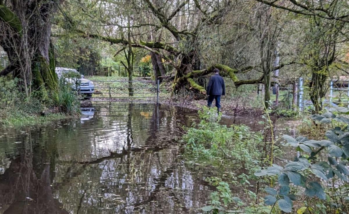
The claimed route went along Wildmoorway Lane from the end of the county maintainable highway at the western end beyond the bridge over the River Churn and towards the Thames and Severn Canal.
But it was not shown on the list of maintainable highways or the county’s definitive map and statement.
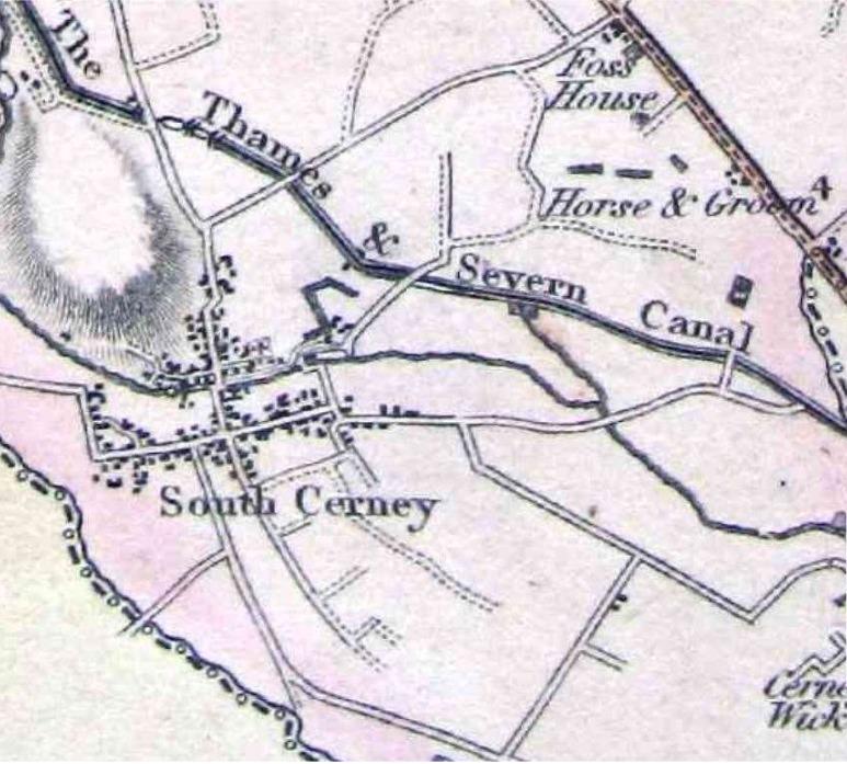
Council officer Andrew Houldey presented a comprehensive report with historic maps which evidence the route’s use as a highway at the commons and rights of way committee on Tuesday, December 12.
These maps included railway, enclosure, Ordnance Survey and parish maps ranging from the early 1800s to 1921.
And he reminded those present at Shire Hall of the legal maxim “once a highway, always a highway”.
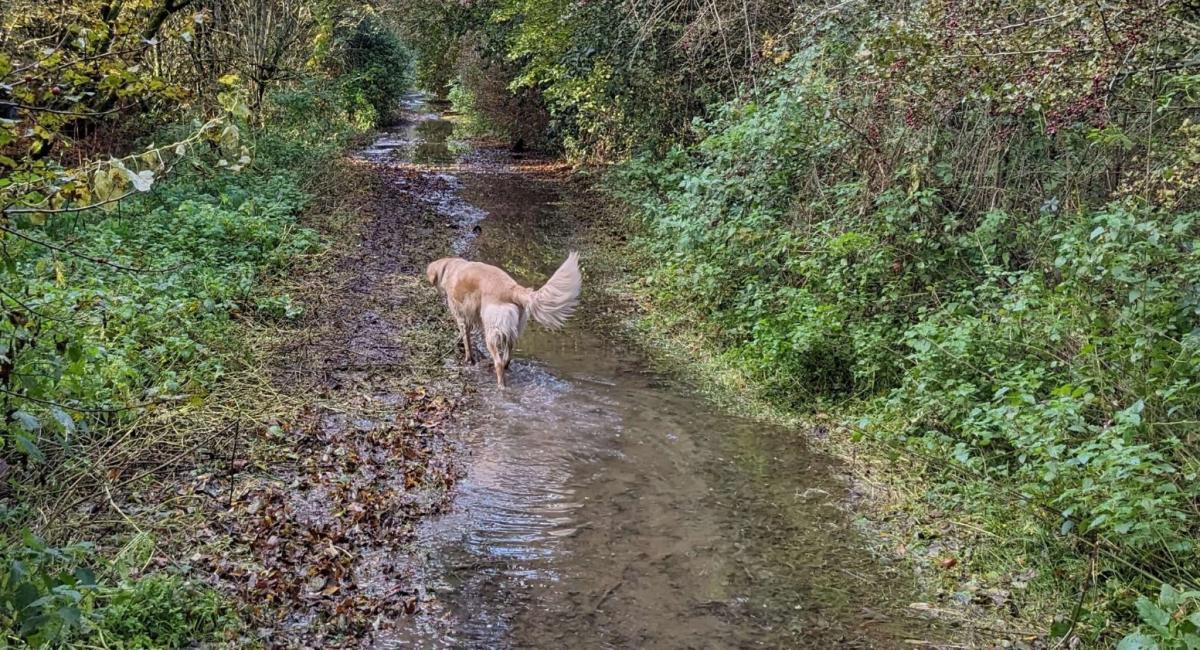
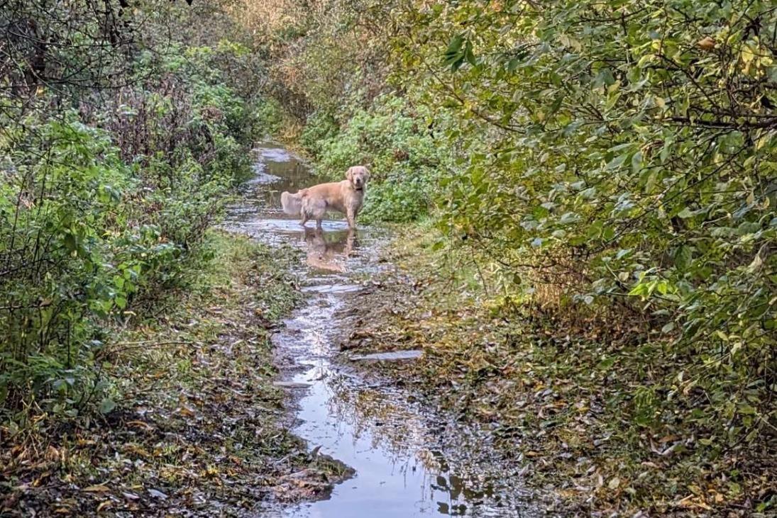
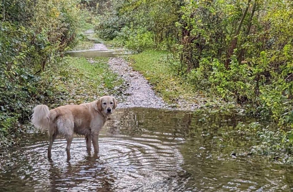
%image('17575978 ', type="article-full", alt="Wildmoorway Lane in South Cerney - photo credit GCC")
Mr Houldey told the committee access rights had been given as part of an enclosure award. This was also evidenced by subsequent railway plans and the Finance Act map.
“If rights have come into being in a distant past, a lack of recent use would not lead to a loss of those rights,” he said.
“The rights can only be extinguished by a legal order. The application here is supported by both documentary and user evidence.”
Councillor Mark Mackenzie-Charrington (C, Stow-on-the-Wold) asked if the committee were to approve the application if they would need to improve the route.
He said: “It’s quite evident that the condition of the carriageway varies enormously.
“Would there be a requirement for some of those watery bits to be brought up to the same standard?”
%image('17575973 ', type="article-full", alt="Greenwood map of Gloucestershire 1824 - photo credit GCC/Greenwood")
Mr Houldey said it was a good question but explained the County Council has the responsibility to maintain not to improve the route.
He said the route wasn’t as wet when it was looked at in 2016 and there is a ditch which drains into the Churn.
The council may undertake some works to make it acceptable for walkers and cyclists.
“It’s something we would be looking at whether we could do something with the drainage. It’s always tricky with these things.
“There’s an expectation when you go into the countryside that you are going to be walking through mud.
“Or if you are walking along a river it is going to be flooded at certain times of the year.
“Underneath, it’s solid. There’s a hard stone surface and you can see clear water running across it. So you’re not putting your foot into water and then mud below that.”
Councillor David Willingham (LD, St Mark’s and St Peter’s) proposed going head with the definitive map modification order to add the length of restricted byway to Wildmoorway Lane.
This was seconded by Cllr Mark Mackenzie-Charrington (C, Stow-on-the-Wold) and the committee voted unanimously to approve it.
“Thank you for a thorough report, as always,” chairman Graham Morgan (L, Cinderford) added.


Comments: Our rules
We want our comments to be a lively and valuable part of our community - a place where readers can debate and engage with the most important local issues. The ability to comment on our stories is a privilege, not a right, however, and that privilege may be withdrawn if it is abused or misused.
Please report any comments that break our rules.
Read the rules hereLast Updated:
Report this comment Cancel