


Britain is bracing itself for more severe weather after snow and heavy rain brought disruption to parts of the country.
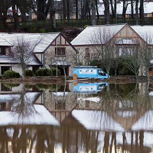
Police Scotland declared a "major incident" as dozens of homes were evacuated in Aberdeenshire when the swollen River Don burst its banks.
Water also spilled from the River Ythan as emergency services mounted an operation to rescue residents.
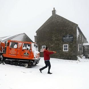
Up to 6cm of snow fell in Northumberland, while a number of roads were blocked and vehicles became stranded because of snow in southern Scotland.
Forecasters said a cold air mass across northern Britain had brought the risk of icy conditions over the weekend.
The Met Office has issued yellow "be aware" warnings for ice and rain across Scotland and northern England on Saturday, with heavy showers also expected in South Wales.
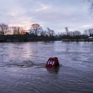
The Environment Agency (EA) said more rain forecast over the weekend had brought the risk of further floods to parts of northern England which are already drenched from severe storms in recent weeks.
Parts of the River Severn in Worcestershire and Gloucestershire are also at risk, the EA said, with flood barriers still in place at Bewdley in Worcestershire and Shrewsbury, Shropshire.
Twenty flood warnings, meaning immediate action is required, and 107 flood alerts were in place across England and Wales.
Jonathan Day, the EA's flood risk manager, said: "Our focus is on offering ongoing support to those communities that are still dealing with the terrible impacts of flooding as we continue with our recovery and repair work.
"With more rain expected this weekend after a December that was the wettest month on record we are asking people to remain vigilant as, with the ground saturated and river levels still high, even normal amounts of rain can cause a flood risk."
With the Met Office three-month forecast suggesting that colder weather could linger until March, forecaster Rebecca Simpson said temperatures could fall to minus 4C in parts of Scotland next week.
"We'll see a shift in the northerly air flow, bringing cold air down from the North," she said. "Quite a few places will see frosty mornings."
Scottish Borders Council said the heavy fall of snow had been a " significant event".
Emergency planning officer Jim Fraser said: "The weather warning in place was for the medium likelihood of low impact, however the impact we experienced was much greater than this."
Chief Inspector Andy McLean, Police Scotland's local area commander, said: "Given the warning for ice, we are continuing to urge residents to take extreme care when out and about.
"Motorists should continue to drive to the conditions and maintain safe stopping distances, bearing in mind that in snow or ice these are significantly greater than in the dry."


Comments: Our rules
We want our comments to be a lively and valuable part of our community - a place where readers can debate and engage with the most important local issues. The ability to comment on our stories is a privilege, not a right, however, and that privilege may be withdrawn if it is abused or misused.
Please report any comments that break our rules.
Read the rules hereComments are closed on this article