


The Cricklade to Cerney Wick Walk
Distance: 6 miles
Time: 3 hours
Pub: The Crown Inn, Cerney Wick
Star-rating: ** Moderate
Starting Point: Town Hall car park, Cricklade
Description:
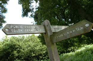
A treat of a walk for all seasons on level ground alongside the Thames and then two linked disused canals undergoing restoration. You pass through North Meadow near Cricklade where thousands of snakeshead fritillaries bloom from late April into May - creating a spectacular display. The walk starts and ends in Cricklade - 11 miles east of Malmesbury, a 20-minute drive along the B4040
About the walk:
For this issue’s walk I was joined by Malmesbury author Judy Jones who has recently self-published two new books on walking and cycling in the Malmesbury and North Wiltshire area. See the book review section of Essence for more information.
We chose to do one of the walks from her book Walks Around Malmesbury and North Wiltshire, and opted for a six- miler starting in Cricklade and looping around to Cerney Wick and back, covering a surprisingly wide variety of terrain. We were accompanied by her dog Fly, who, as it turned out, was central to the idea for the book.
Our starting point was the car park at the Town Hall in Cricklade, although the vast majority of the walk was on footpaths rather than tarmac and was easy going from start to finish with no ascents or descents en route. The route directions below are taken from Judy’s book, along with the map.
As we began our walk I asked Judy her reasons for writing the book, and it soon became evident that an awful lot of research and work had gone into its’ production: "I began to explore the countryside and villages around Malmesbury ,initially, while searching for my lost dog Fly back in 2001. It was quite a revelation.
I was struck by the sheer variety of the landscape - rivers, old canals and railway lines, farmland, lovely villages and village pubs - all well-served by footpaths and bridleways.
Yet the walking guides available at the time tended to overlook north Wiltshire and its borders with south Gloucestershire. It seemed like unchartered territory.
So I saw a need for a book that would help people access this somewhat neglected, but very lovely, area on foot; and help celebrate what it has to offer.
I kept going on about this to friends. They said: "Well you're a walker and writer - you do it."
Having found the dog - four weeks after she went missing - I decided to get on with it, with Fly as my chief research assistant, designing routes doing them at different times of year, then farming them out to other walkers to check for accurancy,clarity and safety.
The result is Walks Around Malmesbury and North Wiltshire, featuring 25 routes of between 3-8 miles in length."
Directions:
From Cricklade public car park next to the Town Hall, cross the road and turn right along the High Street pavement passing the splendid Jubilee Clock - on your right by a road junction.
1. Just before reaching the river, turn left along North Wall. After about 30 yards, bear right to join the Thames path, and enter a field. Keep a boundary on your left as you aim for a metal kissing gate across a gap in the tree line ahead in front of some houses.
2. Once through the gap, bear right past houses on your left, go through a metal kissing gate on the right, and head left across the field. Continue through a metal gate onto a path.
3. Once level with a large barn, turn right over a small footbridge, signposted Thames Path. Follow the path round the back of the barn.
4. Go through a metal gate on your left and continue on the path, keeping the river on your left. You soon enter North Meadow (A). Stay close to the Thames until you reach a footbridge over the river. Don’t cross the bridge. Go over the stile to the right of the bridge, and then turn sharp right, keeping the river behind you.
5. Continue straight ahead along the path, keeping a field boundary on your right (and North Meadow beyond it). As you enter a copse you soon see part of the old North Wilts Canal (B) on your left. Carry on over a footbridge until you reach a fence enclosing the grounds of a house. Go right just before the fence, following the path over a wooden footbridge. Continue ahead onto a drive, going over a cattle grid, then a bridge.
6. About 10 yards after the bridge, turn left and go over a stile next to a metal gate to your left. Go straight on following a track for about 50 yards, to an information board. Follow the path as it bends right down a slope towards the main road (A419) soon to bend left. Keep a metal fence and a tree line on your left. Now you have the route of the Thames and Severn canal on your right. On reaching a road, you should see ahead a restored round house or length man’s cottage built to house canal workers in the 18th century.
7. Turn left onto the road, soon to reach the Crown Inn (tel. 01793-750369) and a T-junction. Cross the road and the stile next to a signpost. Continue ahead to cross a narrow lane, and pick up the path again straight ahead of you. Go through a pair of metal kissing gates. Take the stile to your right into another field, and follow the path with a hedge on your left and a sailing lake - part of the eastern end of the Cotswold Water Park - on your right.
8. At the corner, follow the path round to the right, and soon to the left. After about 100 yards, take a footpath to your left, down some wooden steps over a footbridge into another field. Keep going on the path and exit the field via a stile to join a bridleway - once part of the Midland & South Western Junction Railway (C).
9. Turn left and keep going until you go through a wooden gate across the track. Here you have a choice of routes back to Cricklade (D). You can go left to re-join the Thames Path, and after the footbridge over the river (mentioned at point 4), return the way you came. Otherwise, continue along the railway track to the outskirts of the town, then follow the National Cycle Network route 45 signs, past St Sampson’s Church, back to the High Street. Turn right to return to the car park.
Notes: A: North Meadow, a 112-acre National Nature Reserve managed by English Nature since 1973, has the UK’s largest wild population of snakeshead fritillaries. These delicate wildflowers bloom towards the end of April or early May. One of England’s few remaining ancient Lammas meadows, unimproved and never ploughed, this large sweep of lowland attracts a host of invertebrates, and aquatic birds.
B: The North Wilts Canal opened in 1819 to connect two pre-existing canals - the Wilts and Berks and the Thames and Severn. All three are undergoing restoration. Look out for the information boards just past the house.
C: The Midland and South Western Junction Railway, built in the late 1800s, linked Cheltenham with Andover in Hampshire. Towns along the route included Cirencester, Cricklade and Swindon. Enthusiasts have restored one section of the defunct line to create the Swindon and Cricklade Railway, on which steam trains run regularly.
D: Founded by King Alfred to help defend the kingdom of Wessex from marauding Danes, Cricklade is the most northerly town in Wiltshire, as well as the first town on the Thames. The river was navigable here until the early 19th century. Tourist information is available at Cricklade Town Council, 113 High Street, Cricklade (tel. 01793-751394).
Walks Around Malmesbury and North Wiltshire by Judy Jones is available from Waterstone's, Gardners; Malmesbury, Tetbury and Chippenham tourist information centres. Price £12.95.


Comments: Our rules
We want our comments to be a lively and valuable part of our community - a place where readers can debate and engage with the most important local issues. The ability to comment on our stories is a privilege, not a right, however, and that privilege may be withdrawn if it is abused or misused.
Please report any comments that break our rules.
Read the rules here